


What is GeoJson?
GeoJSON is a format for encoding a variety of geographic data structures. Born from the need to handle geospatial data in a more efficient and web-friendly manner, GeoJSON defines several types of spatial data structures including points, lines, and polygons. These structures are crucial in representing geographical features with their associated properties and spatial extents.
{
    "type": "Feature",
    "geometry": {
        "type": "Point",
        "coordinates": [
            40.783360355115676,
            -73.96533474251368
        ]
    },
    "properties": {
        "name": "Centrale Park"
    }
}
What is a GeoJSON File?
At its core, a GeoJSON file is a text-based format that follows the JSON (JavaScript Object Notation) standards. This means that it's both human-readable and easily parsable by machines. A typical GeoJSON file includes coordinates and can also be extended with additional metadata to enrich the data representation. For instance, a GeoJSON object representing a city might include its name, population, and other demographic details.
One of the key differences between GeoJSON and other geospatial data formats lies in its simplicity and direct compatibility with web technologies. Unlike formats like Shapefile or KML, GeoJSON can be easily integrated into web applications without the need for specialized parsers or converters.
The structure and components of a GeoJson file

1. The FeatureCollection
Think of the FeatureCollection as the main container or the overarching folder of a GeoJson file, organizing various feature types you wish to represent. It's where you'll house all the geographical entities you want to represent, especially when you're dealing with multiple geojson objects or features.
2. GeoJson Features
Each individual entity, whether it's a city park, a meandering river, or a towering mountain, is encapsulated within a Feature, often referred to as a spatially bounded entity. These Feature objects are the essence of GeoJson, and inside them, you'll discover two main components:
a) Geometric Objects:
This is the skeleton of your feature. It represents the actual physical shape or structure, whether that's a singular point, a sequence of points forming a line, or a series of points creating a closed shape. The diverse GeoJson object configurations offer three distinct Geometry Types:
- Point: Represents a specific spot on a map. Essentially, it's a single set of coordinates. Often used to represent points of interest.
- LineString: A sequence of points forming a line. In essence, a LineString is nothing but multiple Points connected in sequence. This could depict pathways like streets or natural formations like rivers.
- Polygon: A closed shape derived from a series of points. At its core, a Polygon is a closed LineString. It must consist of at least four coordinates, with the crucial aspect being that the first and last coordinate are the same position, ensuring the shape is enclosed. This structure can illustrate areas such as parks, lakes, or city limits.
Example : Imagine you're looking for a store on a map. The pin on the store would be a feature object representing a point, indicating its specific location. The path you'd take to get there would be represented by a set of lines or a "LineString". Meanwhile, all the buildings on the map, which have defined shapes and boundaries, would be represented as polygons.
b) Properties
Think of this as the soul of your feature. A feature in GeoJson not only represents a geographic object but also holds additional properties. While the geometry object gives your feature its physical form, the Properties section breathes life into it by providing additional details. Want to add a name to your city? Or specify the area of a park? This is where you'd do it.
3. Coordinate Reference System (CRS): Ensuring Accuracy
While the FeatureCollection and Features give structure and details to your geographical data, the Coordinate Reference System (CRS) ensures that your data aligns accurately with real-world coordinates. Recognizing that different maps might employ varied reference paradigms, GeoJson supports the inclusion of CRS. This invaluable tool ensures that your geographical representations remain consistent, precise, and universally understood, irrespective of the platform.
Advantages of Using GeoJSON
GeoJSON's design offers several benefits, particularly for web-based geospatial applications. Its compatibility with web technologies stands out as a primary advantage. Since GeoJSON is based on JSON, a format natively understood by web browsers and web-based programming languages like JavaScript, integrating geospatial data into web applications becomes straightforward. This ease of use accelerates the development of interactive maps and location-based services.
The human-readable format of GeoJSON is another significant benefit. Unlike binary geospatial formats, GeoJSON can be easily read and edited with standard text editors. This feature is especially useful for debugging and quick modifications. It also facilitates easier collaboration between team members, as the format is accessible and understandable without specialized software.
GeoJSON also excels in scalability and performance. Its lightweight nature makes it ideal for transmitting geospatial data over the internet. When dealing with large datasets, GeoJSON files can be compressed effectively, reducing load times and improving the user experience in web applications. Furthermore, many modern GIS and mapping tools have optimized support for GeoJSON, ensuring efficient data processing and visualization.
Tools for easier GeoJson creation
For those who prefer visual interfaces or are dealing with complex datasets, several tools can assist in generating GeoJson:
- ArcGIS: A titan in the world of GIS, ArcGIS by Esri offers a suite of tools tailored for professionals. While predominantly known for its robust mapping and spatial analytics, ArcGIS also facilitates the creation and management of GeoJson data, especially through its ArcGIS Online platform and various extensions.
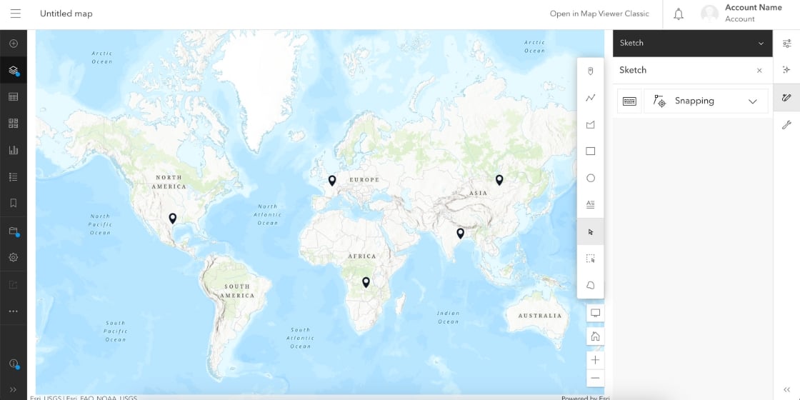
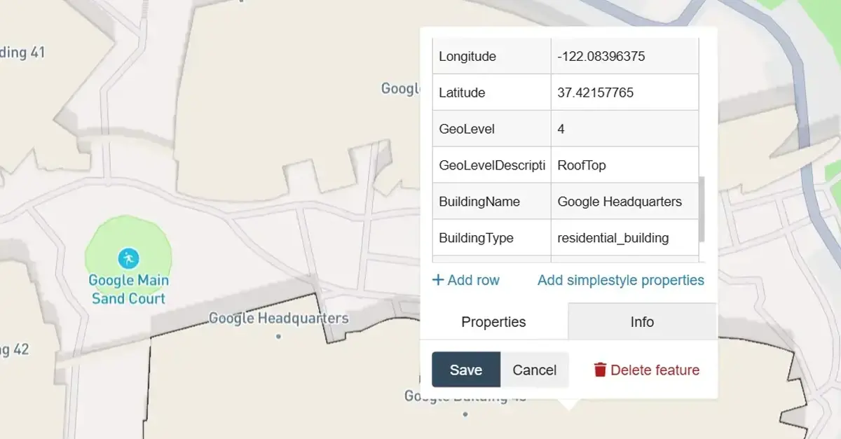
- geojson.io: Perhaps the most popular, geojson.io offers an intuitive interface to draw, edit, and export GeoJson data. You can sketch out shapes on a map and get the corresponding GeoJson output instantly.
- Mapbox Studio: A more advanced platform, Mapbox Studio not only lets you create GeoJson but also offers robust tools to style and integrate maps into applications.
- QGIS: An open-source Geographic Information System (GIS) tool, QGIS allows for the creation, editing, and conversion of a variety of geospatial data formats, including GeoJson.
- Online Converters: If you already have geographic data in another format, various online tools can convert it to GeoJson for you. Just upload, convert, and you're set!
Our partners can easily download GeoJson files directly from our tools, guaranteeing perfect compatibility with many visual interfaces, including industry giants like ArcGIS.
GeoJSON Applications and Use Cases
The flexibility and ease of use of GeoJSON make it a popular choice in various real-world business applications.
Here is a non-exhaustive list of possible use cases:
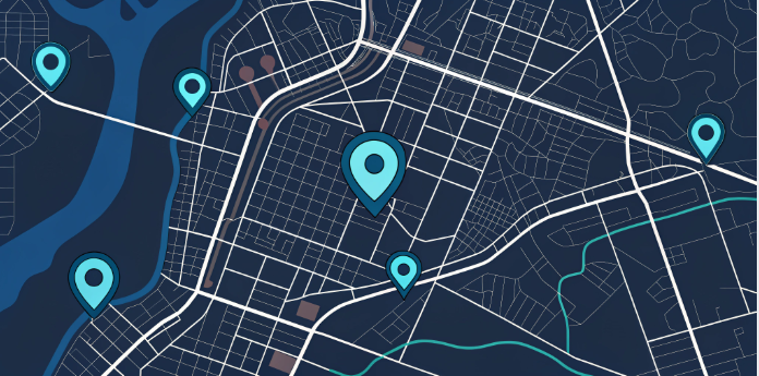
Mapping & Visualization
One of the most common uses of GeoJSON is in web mapping. Web-based mapping platforms like Google Maps and OpenStreetMap can easily integrate GeoJSON data to display geographical features. Developers often use GeoJSON to overlay custom data on these maps, such as displaying the locations of different stores, historical sites, or natural phenomena.
Whether it's the dynamic maps on travel websites, property portals showcasing plot boundaries, or environmental sites tracking natural phenomena, GeoJSON serves as the backbone, making these visual representations possible.
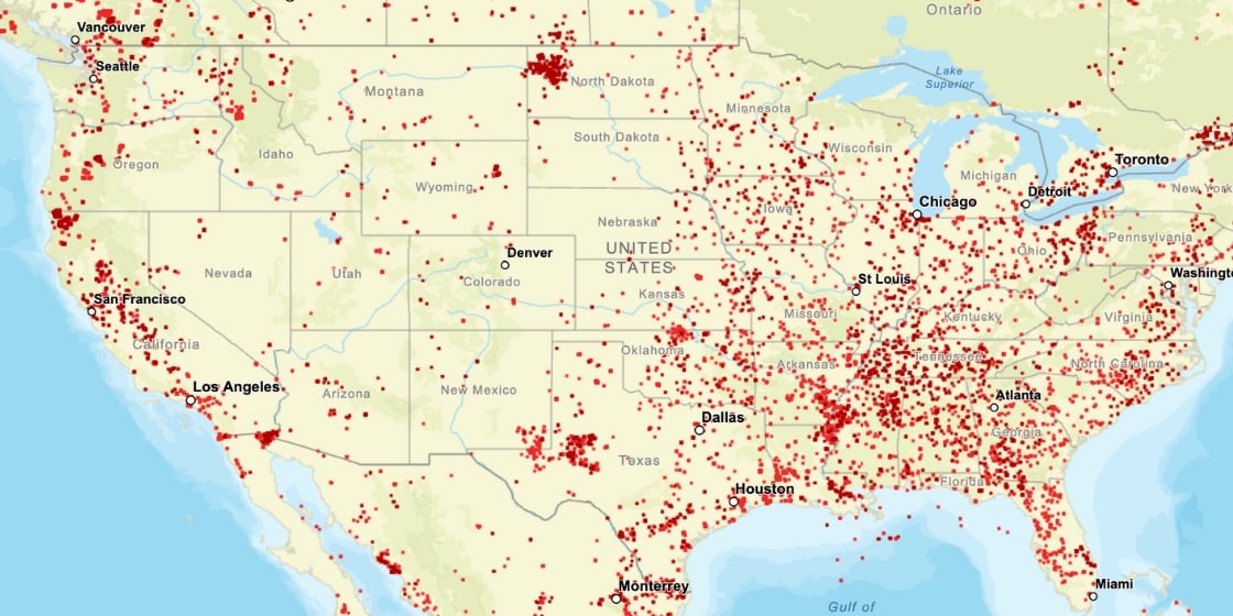
Data Analysis
Beyond mere visualization, GeoJSON plays a crucial role in geospatial analysis. Urban planners, environmentalists, and researchers often use GeoJSON data to study patterns, assess land use, and make predictive analyses.

For instance, environmental scientists use GeoJSON to track changes in natural features like rivers or forests. In city development, it helps in planning things like roads and utilities. Analyzing the GeoJSON data of a city's green spaces can provide insights into its urban planning and development trajectory.
Mobile Apps
The ubiquity of smartphones has given rise to countless location-based services and apps. Whether it's a food delivery app showing you the route your delivery person is taking, a fitness app mapping your morning run, or a tourism app guiding you through a historical city trail.
Gaming and Augmented Reality
Modern games, especially those in the AR (Augmented Reality) domain, like Pokémon GO, rely heavily on real-world geographical data. GeoJSON, with its capability to represent diverse geographical entities, provides the framework for such games, allowing players to interact with virtual entities in real-world locations.
Disaster Management and Response
In times of natural disasters, quick and accurate geographical data can be a lifesaver. GeoJSON files can be rapidly generated to map out affected areas, evacuation routes, and safe zones. These can then be shared and accessed by rescue teams, local authorities, and the public, ensuring coordinated and efficient response efforts.
Challenges and Limitations of GeoJSON
While GeoJSON offers many benefits, it's not without its challenges. Interoperability with other data formats can also present challenges. While GeoJSON works seamlessly with web technologies, integrating it with non-web-based systems or older GIS formats may require additional processing steps or conversion tools. This extra step can complicate workflows, especially in environments where multiple data formats are in use.
Despite these challenges, the flexibility and compatibility of GeoJSON make it a valuable format in the field of geospatial data. Awareness of these limitations is crucial, and developers often work around them by optimizing data handling and using the right tools for specific project needs.
FAQS
What is the format of GeoJSON coordinates?
GeoJSON coordinates are formatted as arrays of numbers in the order of longitude, latitude, and optionally elevation. They are expressed in decimal degrees.
What is the GeoJSON spatial format?
The GeoJSON spatial format is a format for encoding a variety of geographic data structures. It uses JSON (JavaScript Object Notation) to encode geographic data structures like points, lines, polygons, and their collections.
What is the difference between a shapefile and GeoJSON?
Shapefile is a popular file format for geographic information system (GIS) software, developed by Esri, consisting of several files. GeoJSON is a lightweight data interchange format based on JSON, readable by humans and machines. Shapefiles are binary files, less web-friendly, and typically require GIS software to be manipulated, whereas GeoJSON is text-based, more web-friendly, and can be edited using a simple text editor.
Conclusion
GeoJSON is a straightforward format that lets us describe various locations and shapes on maps, using a format that both machines and people can easily understand.
This article covers the essentials for understanding GeoJSON, highlighting its structure, advantages, and diverse applications. From its seamless integration with web technologies to its role in GIS and various real-world scenarios, GeoJSON stands out as a versatile and user-friendly format for handling geospatial data.
Key takeaways include :
- Understanding the basic structure of GeoJSON,
- The benefits of GeoJSON such as readability and web compatibility,
- Practical uses of GeoJSON in mapping and data analysis.
Despite some challenges, particularly with large datasets and format interoperability, the strengths of GeoJSON make it a valuable tool in the geospatial toolkit.
Tools such as ArcGIS, geojson.io, and others can make the process of creating and managing this data both intuitive and efficient.
But if you need support and expertise in GeoJSON, contact Infobel and find out about our services.


Comments